By Patricia McBroom
On
a sunny morning in April, civil engineer Dominick Gulli was out
checking the levees in a critical area of the Sacramento/San Joaquin
delta where fresh water gets diverted to Southern California. The
levees had recently been strongly reinforced to guard against
seepage, overtopping, and collapse from various stresses including
earthquakes. Gulli is out there two or three times a
week to check them out, year after year.
 |
| Dominick Gulli, engineer for upgrade of levees to protect EBMUD aqueduct. |
Keepers of the Levees
Gulli's company, Green Mountain Engineering, is one of three or four local firms who manage this crucial Delta infrastructure, the viability of which is absolutely necessary for the health and welfare of the great majority of Californians. Woodward Island, which we toured that day, is tiny (three square miles) with nine miles of critical levees. If they were to fail, it would jeopardize fresh water delivery to not only most points south of the delta, but to the East Bay of San Francisco as well. That's how connected and complicated the "water pipes" are in this state. Their security depends on a handful of heroes who live and work in the Delta, carrying on the traditions of generations of levee builders who keep the islands dry. |
| Map of California's "water pipes shows EBMUD aqueduct (center) crossing the Delta. State and Federal pumping stations (red squares) lead to California Aqueduct and Delta Mendota Canal (right) |
On Watch in the Delta
And
it's not only the engineers who keep their eyes peeled for levee
damage. Delta farmers, as well, watch all the time, reporting
suspicious activity to their local reclamation districts that employ
the engineers. Just seven years ago, island ranchers saved their levee from a crazy impact by an ocean-going ship on the San Joaquin River that
could have shut down much of the state's water supply.
Civil
engineer Gilbert Cosio, with MBK Engineering firm in Sacramento,
manages the levees in 27 reclamation districts. He's seen enormous
improvements in levee reliability since he began this work in 1984.
“At that time, we'd have to sandbag many miles of levee at high
tide to keep water from going over the top. Some islands would
threaten to flood every three years. They didn't because farmers
down there would throw on the sandbags,” said Cosio. “Now we've
got about a foot of freeboard (above the 100-year flood) almost
everywhere.”
Seven years ago, in 2009, a devastating State report on the condition of Delta levees predicted that, using average probability statistics, there would be about a dozen levee failures by this year. None has occurred.
Seven years ago, in 2009, a devastating State report on the condition of Delta levees predicted that, using average probability statistics, there would be about a dozen levee failures by this year. None has occurred.
Cooperation and Progress
Unbeknownst
to most people who read about California's Delta, levees there have
been steadily improving over the past decade. With State bond money,
and now – belatedly – money from water contractors, a surge in
reconstruction is taking place. Moreover, the work is being carried
out by groups who have long been in opposing camps in the battle for
fresh water: delta residents, state officials and water contractors. It is one of the few places where cooperation is
actually resulting in tangible, physical improvements.
“I
am confident that levees in the Delta are in better shape than
they've ever been,” said state official, Dave Mraz, who heads up
the Delta Levee program at the Department of Water Resources. “It's
taken a lot of cooperative effort. We (State officials) pay money to
pile up the earth out there and provide roads. Then, when the high
waters come, local reclamation districts are out there, doing levee
patrols, watching for seepage and actively treating them in the
middle of a storm. The system still needs that kind of attention
from local interests that have a big stake in making sure their
levees stand. We rely on that. Even with all the work the State has
done, it's a cooperative effort. We provide (some of) the money, but
they do the work.”
EBMUD's Million-Dollar Levees
A
major leap forward was taken six years ago when East Bay Municipal
Utility District (EBMUD) made an historic decision to come up with
millions of new dollars to fortify the levees on Woodward and four
other islands that affect its aqueduct. EBMUD's $6 million paid the
local share in a $41 million levee improvement program – shares
that Delta farmers cannot and should not have to pay to reinforce
levees that benefit 1.4 million EBMUD customers.
 |
| Tiny Woodward Island's widened crown and broadened base protects two critical aqueduct systems in California |
The
results have been outstanding. In a very short time (compared to the
usual slow pace of levee reinforcement), the levees have been raised
in height, often doubled at the crown, and greatly broadened at the
base with tons of new dirt creating a gentle slope down, instead of a
precipitous drop to the bottom.
The
cost of doing all this was not cheap. Forty miles of levee
improvement on five islands cost $41 million. That's a million
dollars a mile, with the State paying 85% of it, and it reveals why
levee improvement in the Delta has been so slow – farmers cannot
afford the local share, even at 15%. (These levees are on private
land and are therefore not maintained by the Federal or State
governments.)
“This
is a real success story,” said Eileen White, water operations
manager for East Bay MUD. “We
did this to improve the stability of the levees out there. Knowing
their vulnerability to failure, we wanted to protect the integrity of
our pipelines,” said White. The retrofit will protect against
floods, seepage of water, damage by rodents and other ordinary
failures.
Earthquake Resistance: The Stronger, the Better
Whether the new work also protects against an earthquake is unknown, partly because levee failure from an earthquake has never occurred in the Delta in historic times. Widening the crest and broadening the base, however, are classic ways of protecting levees against earthquake damage and scenarios for seismic resistance have been tested in the Delta.
White
couldn't say whether the new levees would withstand an earthquake.
She said that would depend on how big it was. “Will this buy
protection in an 8.0 on the Rodgers Fault (a portion of the Hayward)?
I can't tell you that. But it will make them stronger . The more
you do, the better. The wider the top, the flatter the slope, the
more stable it is. It's like retrofitting a house. You put in sheer
walls; then you bolt it down. There's no guarantee in any
earthquake, but we've made the levees stronger without a doubt.”
 |
| EBMUD's aqueduct takes water across the Delta to 1.4 million people. |
Moreover,
the added dirt and stockpiling of rock on the islands makes it much
easier to repair a break immediately rather than waiting days for new
material to arrive, several authorities noted. “If the land
subsides in an earthquake, we can fill it back in quickly,” said
Christopher Neudeck, whose Delta company Kjeldsen, Sinnock and
Neudeck, provided inspection and management services on the EBMUD
project. With new dirt added to the levee, “We just take a tractor
and push it back up. We're doing that everywhere all over the Delta,
adding these berms,” said Neudeck.
Two for One Protection
 |
| So. California's freshwater corridor runs north to south past Woodward island in two tributaries (Old and Middle River) to the San Joaquin River. |
A
disturbing fact about levees in this part of the south/central Delta
is that they are actually dikes that hold water back 24 hours a day
and the landward side has sunk below sea level by 10 to 20 feet.
They are a core infrastructure for water supplies to Southern
California, as well as to the S.F. East Bay. The so called “fresh
water corridor” – small rivers that carry water to the California
aqueduct – runs right past some of the islands recently reinforced.
So, in protecting their own pipes, EBMUD also fortified three of
some seven to nine islands along the corridor.
“By
improving these levees, we not only protect our own supplies, but we
help the 20 million people in Southern California who rely on water
to be pumped from the Delta,” said White. It's a win, win. We have
protected a lot of important infrastructure in California. It would
be really good if other entities out there who benefit would also
step forward.”
Other
“entities” in the area include Metropolitan Water District of
Southern California, Westlands Water District in the San Joaquin
Valley, PG&E, which has transmission lines in the area, Kinder
Morgan with its pipes, a state highway and a railroad. Few of these
has contributed any money to reinforce Delta levees, although MET and six other water contractors, plus PG&E, are stepping forward with
a small amount (totaling less than $500,000 in local share
for all; the State is paying 97%) to reinforce Bacon Island, north of
Woodward on the corridor, next year. (Bacon is one of the islands
recently purchased by MET).
Into the Future with Toe Berms
 |
| Bigger levees with stockpiled material (back, center) protect the island and aqueduct (distance) from being flooded. |
Back
on Woodward Island, Gulli pointed out the “toe berms” added to
the back sides of the levees. The new sides sloped gently down, at a
one to four foot ratio. Many – but not all – of the levees
protecting water delivery routes now have these toe berms. (Engineer
Cosio estimated that the entire fresh water corridor would be up to
the desired Corps of Engineers' standard, PL 84-99, in about five
years).
“We
finished this project two or three years ago,” Giulli explained
stopping the pickup again to draw a graph. “The crown here was 14
feet; now it's 22 feet wide,” broad enough for two trucks to pass
each other. As we prepared to exit the island via ferry, Gulli
pointed out the spot where a levee failed on Jones Tract on a sunny
day in 2004, possibly due to a rodent burrow. The EBMUD improvements
would protect against that sort of calamity and, indeed, no more
failures in the Delta have occurred since that date. But it takes
constant vigilance.
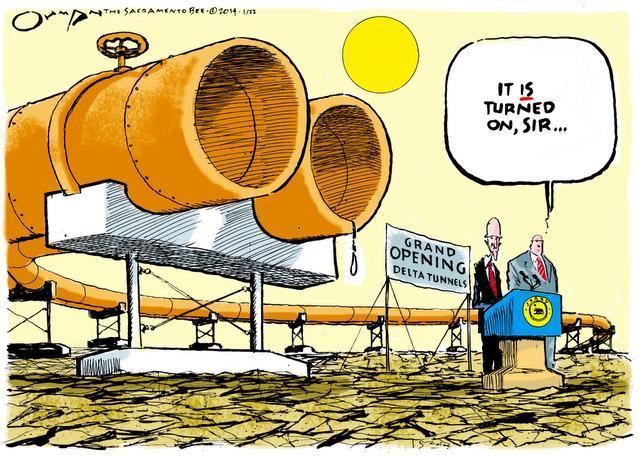
In
any foreseeable plan for California's water future, these levees play
a central role. Even if the State builds two giant 40
feet-in-diameter tunnels deep under the delta to transport water, we
will still depend on these structures to protect our fresh water.
And the one thing that has not been analyzed in the 20,000 plus pages
of environmental reports on the tunnels is the true impact on Delta
agriculture and recreation of a ten-year construction project through
the middle of the place.
The Importance of Skin in the Game
In
October of last year, an independent science board that works with
the Delta Stewardship Council wrote a detailed analysis ( pages 9-17) of what more
than 10 years of heavy-duty construction might do to the Delta economy
if the tunnel project is approved. Such a project would have
“significant adverse effects on the Delta's unique values,” the
report said. Effects on the agricultural economy, recreation values
and way of life in the Delta would be serious and have not been
adequately evaluated, the report said.
It
is possible that such adverse effects could drive out the few
thousand people who maintain this crucial water infrastructure, and
then, the State would lose something it could not replace –the eyes
and energy of people who have skin in the game.