StatCounter

Wednesday, September 9, 2015

DELTA TUNNELS: WATERFIX FOR A BYGONE ERA HOBBLES STATE PLANNING FOR CLIMATE CHANGE

By Patricia McBroom

      Climate in California is changing fast, but, sadly, the State's water system is not. If the Governor and Southern California managers do not reconsider building the largest piece of infrastructure in state history – two enormous tunnels under the delta – they could end up with a very expensive stranded asset (an asset that has become non-productive typically because of climate change). And the State would continue to be hobbled in its planning for the future, as it has been since 2006 when the tunnels were first proposed.

        The aim of the controversial tunnel project, called WaterFix (formerly BDCP or Bay Delta Conservation Plan), is to take water from the northeast corner of the Delta near Sacramento and convey it underground to pumps near Tracy so that it can be exported south. This gives exporters high quality river water and allows them to better manage fish regulations for saving endangered species that have sometimes reduced their take in the south of the Delta. (More on that later.)  And there's some history. State officials have been touring the Southland this summer, promoting the tunnels as the long-awaited completion of the 1960's State Water Project which built the California Aqueduct to transport water from north to south.

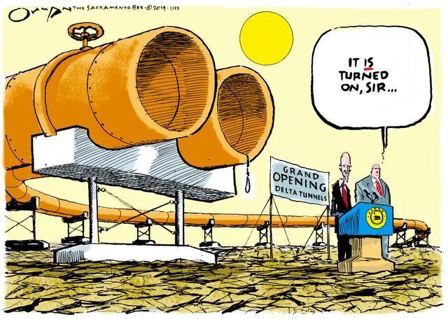
Cartoon by Jack Ohman, Sacramento Bee,  January 22, 2014
        But this is a new age.
Dire predictions of climate change in California are throwing projections of water availability in the Delta into a cocked hat, suggesting that by mid-century, exports could be constrained more by the amount of water coming down the river – and by more urgent needs – than by the location of the pumps. Urban water users in Southern California and farmers in the San Joaquin Valley who are expected to pay for these $15 billion tunnels would be wise to reassess the information created by older environmental reports done for the BDCP.

                             The Looming  Future

          A critical new evaluation of climate change comes from researchers at the Scripps Institute of Oceanography and the U.S. Geological Survey who told state officials in March that snowpack in the Sierras could decline by 35% by 2060. This is higher than the 25% loss projection built into the WaterFix analysis and it would begin to accelerate in 2030, just as the tunnels come on line, if there are no legal challenges to their construction (which is unlikely). What this means is more flooding over a large area and less water stored behind dams which can be channeled down the rivers. As evident in the graph below by Noah Knowles and Dan Cayan, snowpack losses are small (5%) during the first thirty years of this century (blue graph on left) and then quicken after 2030, so that by 2060, (middle graph) another 30% of snowpack is lost.

Pace of snowpack loss accelerates after 2030, when the
tunnels might come online, if they are not challenged
       “The losses are occurring on the fringe of the Sierras,” said Scripps scientist Cayan. These low to moderate elevations do receive snowpack today, but “in the future, as climate warms, that will be vastly diminished.” It is also projected that the lower-elevation northern mountains will lose more snow than the higher mountains of Central California. Again, the loss is to water supplies coming from the Sacramento watershed which the tunnels are supposed to exploit.


Doubling of Drought Risk

       Compounding the snowpack problem is the greatly increased risk of droughts in future decades. The droughts will not necessarily be caused by lack of rainfall, but by rising temperatures. “It's hot and it's getting hotter,” said a speaker at an August climate change symposium in Sacramento. Stanford University scientist Noah Diffenbaugh estimated that the risk of drought will double in the future, mostly due to temperature increases that dry out the soils, hasten evaporation and harden demand. Water is less likely to be exported from the north Delta tunnels during droughts, so the new intakes and tunnels will be of less and less use as the years pass, bringing higher temperatures. Depending on a drought's severity, water will continue to be exported from the south, but a doubling of risk has not been analyzed by WaterFix.

        At the same time, increased flows to the ocean will be needed to hold back rising sea levels that carry salt into the fresh waters of the delta. Moderate projections call for a 16 inch increase in sea level at the Golden Gate by mid-century, but storm surges and high tides will periodically drive levels much higher, requiring ever more flow to push back the salinity. High sea levels combined with drought will be killers, especially for reservoir storage.


                                    Confusing Data for Benefits

       So, why do tunnel advocates think they will get more water by building a north Delta intake? The answer is based on assumptions rife with confusion and obscure data.
       Government drivers of the project in the Natural Resources Agency say that a northern intake will recreate more natural river flows through the Delta and halt the completely aberrant backward flows that have pertained for decades, carrying fish to death in the south pumps. Federal regulations to save the fish have sometimes stopped water deliveries temporarily and the exporters yell bloody murder when that happens, blaming the Feds for a “Congress created Dust Bowl.” Therefore, a well-screened northern intake should avoid the cutoffs and create better flows for fish. Voila, more water for export. The graph on the right shows a threatened future reduction in exports (to 3.5 maf) if the tunnels are NOT built.


 "Awful" Place for the Pumps


Graph based on the BDCP analysis posits that exports will
be cut to 3.5 maf if the tunnels are not built due to new
regulations for fish – a controversial claim.
       Fish biologists agree that the south Delta is a terrible place for the pumps. In rapid-fire succession, the Natural Resources Defense Council biologist Tina Swanson reeled off the following questions:
      “Could you come up with better place to divert water than what we have? Absolutely.
       Is there a better place for water quality? Absolutely
       Could you have less impact and entrain fewer fish? Absolutely.
       So, yes, there are better places for the pumps, but it is worth it?” she asked.

       The Bay Institute's fish biologist, Jon Rosenfield, agreed that the southern location for the pumps Is “awful”, but he added that the tunnel plan fails in three ways, on timing, cost and efficacy. “Even its own documentation doesn't claim that it will provide much benefit, and the impact analyses dramatically overstate the benefits and understate the negative consequences,” he said, in an interview. Rosenfield also said that export cuts to save imperiled fish have been very infrequent during the current drought, and that the main reason for limiting exports has been to keep the salty tides at bay, i.e. to maintain fresh water for users (which include water districts in Contra Costa County).


               Pushing the Salt Back – An Overriding Problem


       The idea that salinity control is the overriding problem exporters face is backed up by experience with drought last year when 71 percent of the flow through the delta was needed to push back salty water, according to a report from the Public Policy Institute of California at UC Davis.  It is hard to gauge how much fresh water will be needed to push back the salt in future decades, but California's water system has been built for snowmelt, and the loss of snow, combined with increased drought and higher seas, raise alarms.
       Felicia Marcus, chair of the State Water Resources Control Board – a critical regulatory body – told a group of lawyers last November,Over the decades, we do have to think about sea level rise because we’re going to have more salt water intrusion and there’s no way we’re going to have enough water storage to repel it like we can today and we’re going to have to think differently about that.”
       Evidence that the major exporters ARE doing some new thinking came last month in a meeting of the Metropolitan Water District of Southern California, when director Roger Patterson called for another analysis of the WaterFix that would compare the tunnels with a “No Action Alternative.” He called the data represented in the BDCP graph “confusing.”


                                            Financial Losses and Tradeoffs                                                         

The beautiful and endangered Sierra watershed nourishes all life.
         And what about the financial consequences of building a colossal underground watercourse that may not be used often enough? Economist Jeffrey Michael of the University of the Pacific estimated that -– based on figures of water yield generated in the State's own reports – exporters might recover $5 billion in benefits for the $15 billion spent. Moreover, he wrote in a July column in the Sacramento Bee, “the benefit-cost ratio is even worse when the negative impacts to the Delta and risks to the environment and upstream interests are considered.”


                                            What We Could Do

        Finally, there is the impact on credit for water districts and exporters who invest in the tunnels – if they don't pan out. The enormous expense could sink other efforts to pay for water infrastructure that really does help with climate change – projects like capturing storm waters, recovering the flood plains of old creeks and rivers, building more recycling facilities, storing water underground,  erecting earthquake-resistant levees, even perhaps creating hundreds of ponds on farms for irrigation and storage.
                                        
The list is long for regional projects that could move California from an old water system, built for the 20th century, to a new one. All of our systems and expectations are built on what used to be normal, says Diffenbaugh, senior fellow at the Stanford Woods Institute for the Environment. If we are going to “avoid disasters now and in the future, we have to acknowledge that California's climate has changed.”


Monday, May 4, 2015

ANCIENT TRADITIONS REVITALIZE SIERRA WATERSHEDS; INCREASE WATER

By Patricia McBroom
       In the mountains above Fresno, a slim, beautiful wild plum has taken root in a newly cleared meadow. No one planted the tree. It simply sprouted on its own, once the overgrowth was pushed out by Native Americans working to revitalize the forest.
      The blooming presence of this sapling stands as testimony to what can be done to not only restore a meadow but to thin the forest and thereby bring more water down from the Sierra Nevada mountain range.                                                    

                                                                                  More Water

A wild Sierra Plum tree sprouted naturally in
the restored Progeny meadow, east of Bass Lake.
                                          credit: Ron Goode
       Experts have been talking for years about thinning California's forests to enhance the water supply downstream. No one knows exactly how much more water the Sierras could produce if the dense undergrowth was removed, but it's a lot – two, three, up to 16 percent (p.2) or more, of current yield. While estimates vary, most reflect a recognition that reversing the century's old habit of suppressing fire in the watershed is critically needed.
      “Failure to understand the urgency of the situation in the Sierra Nevada will have devastating impacts on California's environment and economy,” warns the Sierra Nevada Conservancy in a new report on the need for prescribed burns and thinning in the forests.
       The Conservancy, a state agency, was referring mainly to the risk of huge wild fires, like those that have been growing in size every year. But authors of the report, The State of the Sierra Nevada's Forests, also estimate that up to 60 percent of snowfall never reaches the ground because the tree canopy is too thick. Much of that snow then evaporates and never reaches downstream use. On the other hand, when wildfires rip through the forest, they take out every tree and nothing is left to shade the new snow, which again is lost to the air and early melting.
      A golden mean is needed – some trees, but not too many, and a forest cleared of dense underbrush so that when fire does come, it stays on the ground. A wet meadow, for its part, acts to control the wild fire. It is the forest's sponge, holding water late in the year and releasing it slowly into streams and groundwater. Many, if not most, of the Sierra's meadows have been degraded, no longer functioning as sponges or sources of species diversity.
North Fork Mono Tribe chief Ron Goode has worked for
decades to revitalize his homeland with traditional knowledge of
 prescribed burns and forest ecology. credit: Patricia McBroom 


            Ancient traditions

 I was in the Sierra National Forest, which surrounds the San Joaquin River watershed, between Yosemite and Sequoia, to find out what the North Fork Mono Tribe was doing to recover the health of the forest there. It is their ancient homeland and while most of the several thousand Indians – those who survived genocide – were driven out of the mountains a century ago, many of them still carry traditional knowledge of forest stewardship.
       “Prior to the arrival of Europeans, the use of fire by North Fork Mono and other California Indian people enhanced plant and animal resources and sustained a higher human population density than intensive, seed-crop agriculture could have supported,” writes Jared Dahl Aldern, an environmental historian and co-director of the Stanford University-based Comparative Wests Project.


                                    Gardeners of the Forest

       “These were the gardeners of the forest,” said Douglas McKay, head archaeologist of the Sierra National Forest's heritage program, as we rumbled in a Forest Service jeep through the woods from meadow to meadow. McKay explained that the several hundred thousand Indians who originally lived there had maintained healthy forests with regular controlled burns that preserved the meadows, increased the diversity of species and protected against wild fire.
       “We need the gardeners to come back and start taking care of the land again.” said McKay, adding that most of what scientists describe as a “natural” forest with a clean understory was actually created by Indians.
Wood and debris waiting to be removed after meadow restoration in the
Sierra National Forest. credit: Patricia McBroom
      Seated beside McKay in the jeep was one of those head gardeners, Ron Goode, tribal chief of the North Fork Mono, a founding father of a movement to help federal land managers understand the role of Native Americans on the landscape. Goode has been prodding and poking for 30 odd years to bring back traditional burning and native knowledge.
       “A good meadow has up to 55 species, including food, medicine and other useful products,” said Goode. “This meadow was brown when we started,” he said, pointing to a green space in the trees filled with flowers and new grasses. “Before, all we had was thistles and brush. Now we have bees, flowers and plants. The water is providing for all of that.” Goode is participating in the Dinkey Creek collaborative, an effort to restore 154,000 acres in Sierra National Forest with thinning and meadow revitalization. It's one of the larger Forest Service projects in California, representing about 10 percent of this national forest (1.3 million acres). But it's a drop in the bucket, compared to what needs to be done.


                                    Benefits of Forest Restoration

        In a large scientific review of water supply benefits, the Nature Conservancy recently estimated that tripling the pace of current forest restoration would result in up to a six percent increase in the mean annual streamflow from individual watersheds. The restoration would pay for itself in these water benefits, the non-profit conservation group concluded.
Sierra National Forest has 1.3 million acres, half of which is
in need of thinning; the rest is protected wilderness areas.
credit: US Forest Service
       Yet, the Forest Service is crippled by loss of personnel due to Congressional cutbacks. Controlled burning usually can't be done because of resistance by air pollution boards, or public misunderstanding. Moreover, the forests are now so choked with flammable material that a prescribed burn could easily turn wild. And it's dry and hot. And there's no money. Most of the money that U.S. land management agencies such as the Forest Service or the Bureau of Land Management have early in the year for proactive management is swallowed up later by the need to fight fire.


            The Karma of Doing Nothing

       “Pick your smoke.” says the Sierra Nevada Conservancy, in advocating for controlled burns. Adds McKay, “Mother nature will do it if we don't and you will not like the result.”
       What then can we do? If government agencies can only respond to crisis management of wild fire, there will be little effort to fix the State's crucial watershed – the magnificent mountain range that stretches 400 miles from Bakersfield to the Oregon border which is the source of 60 percent of our developed water supply. Moreover, climate change is reducing the snow pack to a frightening degree; there is an urgent need to make the best use of what falls from the sky.
       Against these odds, McKay is optimistic. “We have the ability to fix this problem, but we need some funding,” he said. McKay wants to see tribal people employed in a modern day Conservation Corps to initially clear the forest of its dangerous overgrowth by mechanical means, then maintain a clean forest with low-intensity prescribed burns every few years.
Forest archaeologist Douglas McKay wants a
modern-day Conservation Corps to restore the
Sierras: "We can fix this problem," he says.
credit: Patricia McBroom
       Native Americans lived in and maintained the Sierra Nevada mountains with such burns for more than 9,000 years until European contact. We could do worse than use their knowledge. The small burns not only kept wild fire under control, but they were necessary to maintain the ecological health of a wide variety of animal and plant species. Giant Sequoia trees, for instance, require periodic fire to regenerate and are at risk from fire suppression. Sierra meadows are primary resting places for millions of migratory birds on the Pacific flyway. 


             Collaboration and Money

       But are there enough Indians to do the job? “There are plenty of Indians,” replied Goode. Some 6,000 Indians from 13 tribes still live in or near the Sierra National Forest, with many more thousands further north. “Anyway, all you need is one, who knows what he's doing.” Young Americans of all backgrounds could then be employed to serve the nation under a collaborative effort by many organizations including tribes.
       That is exactly what the Forest Service is trying to put together now. The Dinkey Creek Landscape Restoration Project, for example, involves 30 different organizations – state, federal, non-governmental, private and Indian – which have so far thinned thousands of acres of forest and are preparing to restore the meadows.
       “We need to be putting together more of these collaborative groups,” said McKay. “All we need is the money.”